GPS » Global Positioning System, Satellite navigation explained
Updated: 17.04.2024 | Reading time: 7 minutes
This text is machine translated.
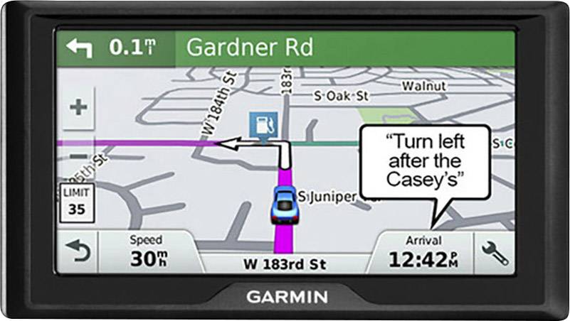
How does the navigation device in my car know where we are?
If you ask other sat nav owners, the answer is usually: Well, from the GPS satellite! Ah yes, and how does the GPS satellite know where the sat nav is? Unfortunately, the follow-up question remains unanswered in most cases.
Even though almost everyone has used the advantages of modern satellite navigation at some point. Reaching unknown destinations or driving through the maze of streets in foreign cities is child's play with a navigation device. It's not just sales representatives who appreciate the time this saves.
But how exactly does this electronic orientation aid, which goes by the name of GPS, work? We will be happy to explain the sophisticated technology behind a global navigation satellite system, or GNSS.
GPS stands for Global Positioning System and describes the worldwide determination of one's own position with the help of satellites. The correct name is NAVSTAR GPS and is the abbreviation of the American term Navigational Satellite Timing and Ranging Global Positioning System. The GPS system is operated by the US Department of Defense and has been operational since the 1990s.
However, it was initially less suitable for civilian use. This is because an artificially generated inaccuracy (selective availability) worsened the results for non-military purposes. Deviations of more than 100 m were the result. It was only when the artificial degradation was switched off on May 2, 2000 that civilian users were able to achieve positioning accuracy of less than 10 meters. This paved the way for GPS to be used for a wide variety of applications.
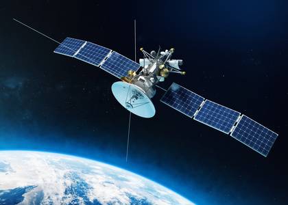
The GPS satellites definitely don't know where our car navigation systems, smartphones with navigation aids and all the other GPS receivers are located. Nor do they need to know.
The GPS satellites simply send their GPS data to earth in a continuous sequence. That's all they do. But this sophisticated and coded data is quite something. Because every navigation device can use this information to calculate its own location in a matter of seconds. What sounds quite simple in theory is, however, extremely complex in practice.
Number of GPS satellites
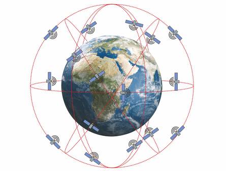
First of all, you need a certain number of navigation satellites. In the case of GPS, this is 24 - 30 satellites orbiting the earth on 6 orbital planes and at an altitude of approx. 20,200 km.
This ensures that at least four and in practice six to eight satellites can be received at the same time.
The satellites have high-precision atomic clocks on board and orbit the earth twice per sidereal day. A sidereal day lasts exactly 23 hours, 56 minutes and 4.091 seconds.
This results in an impressive satellite speed of approx. 3.9 km/s.
The distance calculation
The satellite transmits its individual identifier, the current GPS time and its orbital data to the earth in consecutive order.
The receiver can then use this information to calculate the exact satellite position for each point in time.
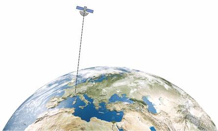
Based on the transit time of the signal from the satellite to the receiver (approx. 0.07 seconds), the distance between the receiver and the satellite can also be calculated.
This provides the most important data. The receiver knows where the satellite was at a certain time and how far away it was.
The positioning
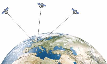
However, it is not yet possible to calculate a position using the values from a single satellite. Only when at least 3 satellites have been received and the data evaluated can the position be determined or the exact position calculated.
Or to put it another way: if three routes of different lengths are created at three points where the position is known, triangulation can be used to calculate the point at which the three routes meet.
Theoretically, there would be a second point beyond the satellites in space, but this is not relevant for our purposes or for GPS navigation.
The time factor
The GPS receiver must also have an extremely accurate clock so that it can precisely determine the different transit times of the satellite signals and therefore the distance to the satellite. This is because a deviation in the receiver clock of just 1/1000 of a second (millisecond) would result in a distance error of approx. 300 km.
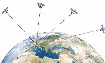
As high-precision atomic clocks cannot be used in the receivers, the time deviation of the receiver clock from the GPS time must be determined individually. In addition to the three satellites used to determine the position, a fourth satellite must be received for time correction. This means that at least four navigation satellites must be received in order to determine the exact position.
Thanks to the coded signal transmission (C/A code), the receiver clock can be synchronized to such an extent that the distance to the satellite is calculated with a deviation of only a few metres.
By the way:
As the GPS system time does not have a leap second, the GPS system time is now about 20 seconds ahead of universal time UTC. The reason for this is the fact that an average solar day lasts a fraction of a second longer than 86,400 seconds. An additional leap second is therefore inserted into universal time UTC at regular intervals.
The data output
With GPS, the target coordinates calculated by the navigation device refer to the World Geodetic System 1984 (WGS84), which serves as a standardized basis for position information on earth and in near-earth space. In this system, GPS coordinates can be specified as latitude and longitude, e.g. 45° 12` 25.18`` N / 7° 1` 12.3`` E or as a decimal 48.175741° / 6.025975°. The decimal values for positions south of the equator or west of the prime meridian (London Observatory in Greenwich) are indicated by the device with a negative sign.
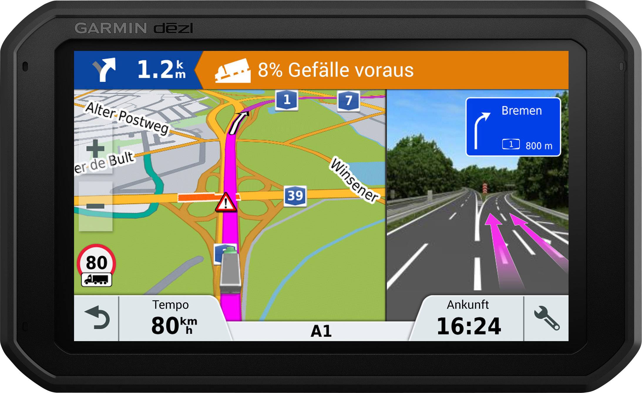
If appropriate map material is stored in the navigation device, the current position can be shown on a map with streets. With computers or smartphones, the route data can also be displayed in Google Maps.
The accuracy of GPS is usually less than 10 m and depends on many factors.
In addition to time and propagation errors, the ionosphere also has a negative effect on the accuracy of positioning.
However, many of the disruptive influences can be reduced if the number of satellites that can be received is increased. If not just three but six, seven or even more satellites can be used to determine the position, the accuracy of the position determination is significantly higher.
However, the receiver needs a “clear view” of the satellite. Unfortunately, undisturbed GPS reception is not always possible.
Buildings, trees and the natural terrain can shade or reflect the signal.
Shading in cities
Many tourists use their smartphone's navigation function to find different sights or restaurants more easily when strolling through a city. Particularly in cities with tall buildings or narrow streets, this can lead to massive shading.
By the way:
If the current map material is used online, this is at the expense of the data volume. If the maps are downloaded to the smartphone in advance, a lot of device memory is required. You need to think carefully about which version you choose, especially when traveling abroad. This is because online navigation can quickly lead to high costs.
In addition to GPS satellites, high-quality quadrocopters used for photo and video recordings also receive signals from the GLONASS navigation system. This greatly increases the number of satellites that can be received and also the accuracy of positioning.
As a result, the copters are able to automatically maintain their hovering position to within a few centimetres.
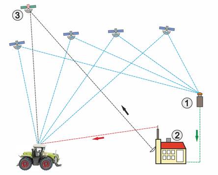
The abbreviation DGPS stands for Differential Global Positioning System. DGPS is used, for example, when agricultural machinery needs to be controlled with centimeter precision for field work.
But DGPS is also used in surveying. For this purpose, classically measured GPS receiving stations (1) are used as reference stations to determine the deviation between the calculated GPS position data and the actual position.
The corresponding correction data (green) is transmitted to distribution stations (2), which disseminate the correction data by radio (red) or online via the Internet.
At the same time, the correction data signal (black) is also distributed via geostationary satellites (3) so that the correction values are also available for large areas. The DGPS system EGNOS performs this task for Europe.
What does GLONASS mean?
GLONASS stands for Global Navigation Satellite System and is the Russian version of the US NAVSTAR GPS. GLONASS is based on a system that is very similar to GPS. This is why quadrocopters, for example, can use the signals from both systems for navigation or autonomous flight maneuvers.
What is the Galileo navigation system?
Unlike the US NAVSTAR GPS, the Russian GLONASS system or the Chinese Beidou system, the European GPS system Galileo is not operated by military institutions. The European Union wants to use the Galileo navigation satellites to enable GPS positioning in the civilian sector and make itself independent of other countries. The extent to which the navigation device is suitable for Galileo satellites must be looked up in the device documentation or requested from the manufacturer.
How do the compass and speed display work?
If the receiver is in a moving vehicle, the speed can be calculated based on the changes in position over a certain period of time. The direction of movement can also be determined. However, both only work with a receiver that is in motion.
