Highlights & Details
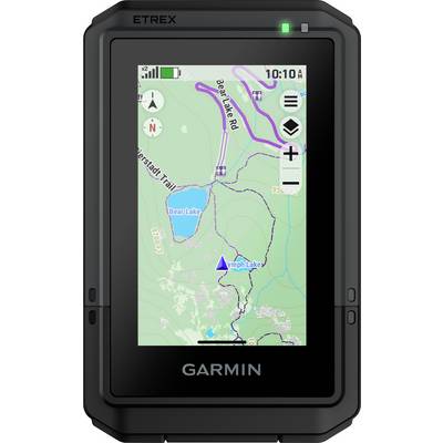
Garmin eTrex Touch Outdoor GPS
- Outdoor handheld device with 3" (7.6 cm) color touch display
- New and robust design in pocket size
- Handheld device for outdoor activities like hiking, biking, skiing, kayaking, geocaching and more
- Pre-installed TopoActive maps
- Compatibility with outdoor maps+
- Round-trip routing
- Precise position determination thanks to multi-frequency reception
- Battery runtime of up to 130 hours with SatIQ technology
- USB-C interface
- New brackets for more attachment options, e.g. for your bicycle
Technical specifications
- Battery life: All satellite systems + multiband: Up to 130 hours, expedition mode: Up to 650 hours
- Interface USB-C
- Memory/log: 32 GB (the available space for users depends on the built-in cards)
- Dimensions: 66 mm x 105.4 mm x 24.6 mm (2.6-inch x 4.15-inch x 0.97-inch)
- Water-tightness IP67
- Display type: 3 inch transflective TFT color display
- Display size: 3.88 cm x 6.48 cm (1.53-inch x 2.55-inch); 7.62 cm (3-inch) diagonal
- Display glass: Chemically reinforced glass
- Use
Hiking
Cycling
Skiing
Geocaching
Sailing
- Product type
Geocaching
- Features
GPS
GLONASS
- Screen size diagonal (inches)
3 inch
- Display (cm)
7.6 cm
- Max. battery life
650 h
- Width
66 mm
- Height
105.4 mm
- Depth
24.6 mm
- Weight
150 g
- Dim
(W x H x D) 66 x 105.4 x 24.6 mm
- UKCA
not relevant
Documents & Downloads
Datasheet
Datasheet 3521416 Garmin eTrex Touch Outdoor GPS Hiking, Cycling, Skiing, Geocaching, Sailing GPS, GLONASS
User & Safety Instructions
User & Safety Instructions 3521416 Garmin eTrex Touch Outdoor GPS Hiking, Cycling, Skiing, Geocaching, Sailing GPS, GLONASS
Description
This text is machine translated.
Scope of delivery
- ETrex Touch, charging/data cable and documentation
What kind of Outdoor Navigation are you looking for?
Accessories
(*All information is plus legal VAT)The necessary accessories are required to use the article as described.


